
OMEGA Community Noise Study: Indices to enhance understanding and management of community responses to aircraft noise exposure
04.15.2009 | HMMH |


A recent study conducted in the U.K. demonstrates what we have known anecdotally for years – that DNL is not an effective tool for communicating the impacts of aviation noise. The study asked focus group members to evaluate a range of traditional and “supplemental” noise information. The goal of the study was not to undermine existing contour-based noise metrics but rather to establish whether these could be enhanced if other explanatory information was added.
The study concluded the following:
- -There was considerable variation among focus group members in their interpretation of different metrics used to illustrate the same noise environment.
- -There was general dissatisfaction among members of the public with the aggregated indictors such as Leq and Lden.
- -All the aggregated indicators required considerable explanation before participants understood the illustrations.
- -A preference for metrics that disaggregate key elements of aircraft noise: namely, time, frequency of events and individual sound levels.
- -A desire for a wider range of noise exposure illustrations, especially among members of the public living close to airports.
- -Universal acknowledgement that bar charts, for specific locations illustrating the numbers of events within ranges of maximum sound levels for given periods of the day, were the most informative and easiest to interpret of all the metrics viewed.
- -Consensus that the flight path densities maps were the most visually attractive despite the lack of specific noise data contained therein. To combat this, a number of participants suggested that this image could be overlaid on aggregated noise footprints such as N70 or Leq contours.
- -That the public is more interested in site specific information that is easy to interpret in relation to their own personal exposure, rather than more complex images that may provide a comprehensive overview of the whole noise environment around an airport, as conventionally used by planners and decision-makers.
See figures below for examples of flight path density maps HMMH has prepared at Fort Lauderdale International Airport for their Quieter Skies Report.
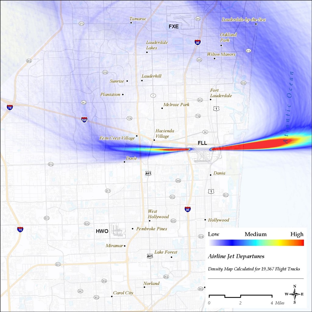
Airline Jet Departures
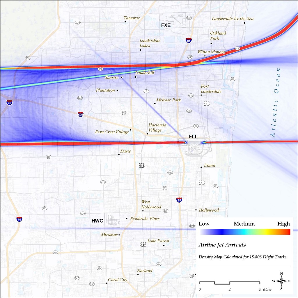
Airline Jet Arrivals