

Master Plan and Noise Exposure Map (Part 150) 2012 Updates, Nashville International Airport
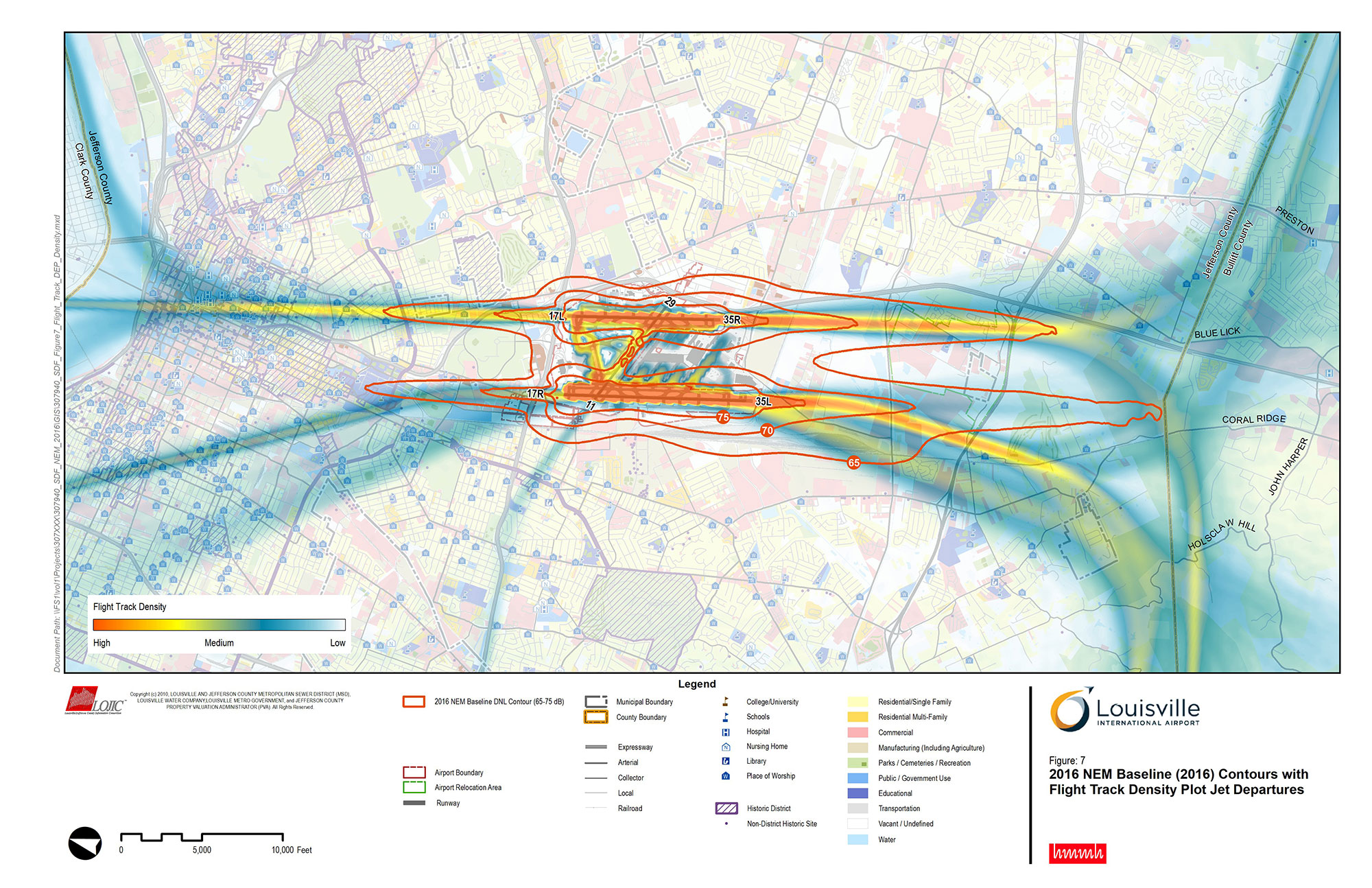
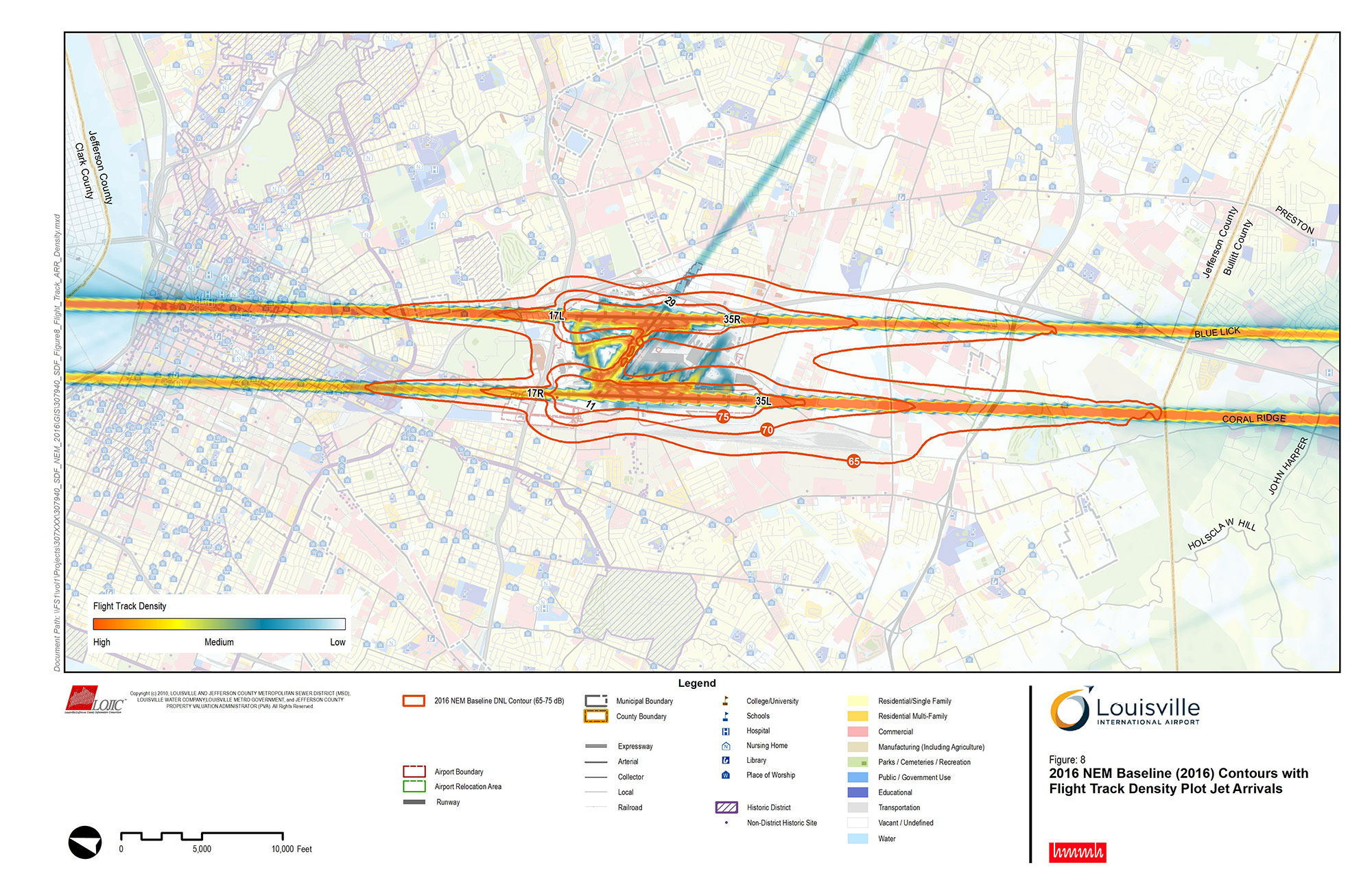
The Louisville Regional Airport Authority (LRAA) contracted with HMMH to update their Noise Exposure Map (NEM) per Title 14 of the Code of Federal Regulations Part 150 (14 CFR Part 150), providing a 2011 and 2016 NEM document. The most recent NEM includes updated noise contours depicting the current (2016) and five-year forecast (2021, see above) aircraft operations at Louisville International Airport (SDF). The NEM Update included:
- Non-standard aircraft operational profiles for three cargo aircraft types based on conversations with the operators of how they actually operate these aircraft at SDF;
- FAA implementation of Area Navigation (RNAV) flight procedures in the five-year forecast contours; and
- Actual flight tracks from a complete year of flight operations using our proprietary Integrated Noise Model (INM) preprocessor, RealContours, which captures actual aircraft flight tracks rather than the standard representative flight tracks developed in the noise model.
Review of the 2015 flight tracks and conversations with UPS, the major cargo carrier at SDF, determined UPS does not adhere to the RNAV departures during the night due to the high volume of aircraft operations. The new NEM showed that a community that was supposed to be avoided by one of the RNAV departures is indeed being overflown at night; that community is now included in the 65 DNL contour and potentially eligible for noise mitigation.
HMMH periodically updated the Community Noise Forum, which was the Authority’s technical advisory committee for this project. HMMH also presented the 2011 and 2017 NEM updates to the public in a workshop environment.